 Wawawai and Snake River Canyons
 Wawawai and Snake River Canyons
|
Use your browser's "back" feature to return to this page
|

|
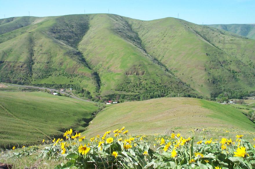
Wawawai (waa-WAA-wee) Canyon in April. This is about
as green as it ever gets. Winter rains recharge the soil of this arid
land and the pastures yield a spurt of growth. By mid-June this
freshness gradually fades; by July all becomes scorched tan.
You can see the white roofs of our house and garage at the bottom of the gully at the left. The red roof belongs to the house on the far side of the highway.
Enlarged view, 101kb.
|
|
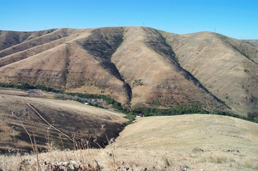
Orrin got out of shape over the winter of 2001/2002, so he began daily climbs this far up the canyon's north wall. This vantage point sits about 1,000 feet above the house. The transmission line steel towers are a bit over a mile away. Another 3 to 500-feet of vertical ascent brings one to the canyon rim. Loose rock and a steeper incline make it impractical to go higher on daily outings. The less-than-sure footing increases the of odds of taking a fall. But, for the sake of variety, it's fun to go all the way to the cropland, above, and follow another ridge back down. A view from the top allows one to look over the power line ridge and see the Blue Mountains in the distance. The "Blues" don't look like mountains at all. They appear as a huge mound on the horizon.
|
|
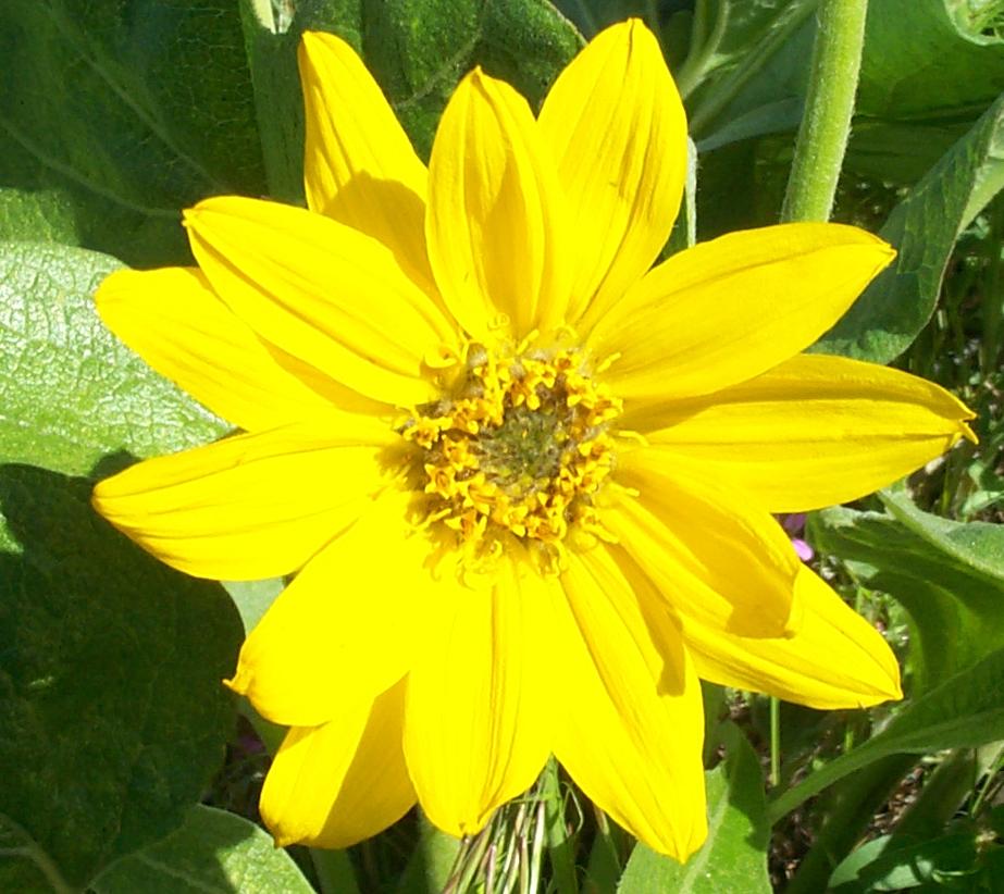
The yellow blossoms are those of a native weed, the arrowleaf. They
are some of the earliest flowers to appear, usually right after the
daffodils.
By hunting season the arrowleaves dry out and become crisp and loud. If you step on one the sound is like that of walking on potato chips. Every deer within shooting range will then know danger is afoot. Enlarged view, 95kb.
|
|
|
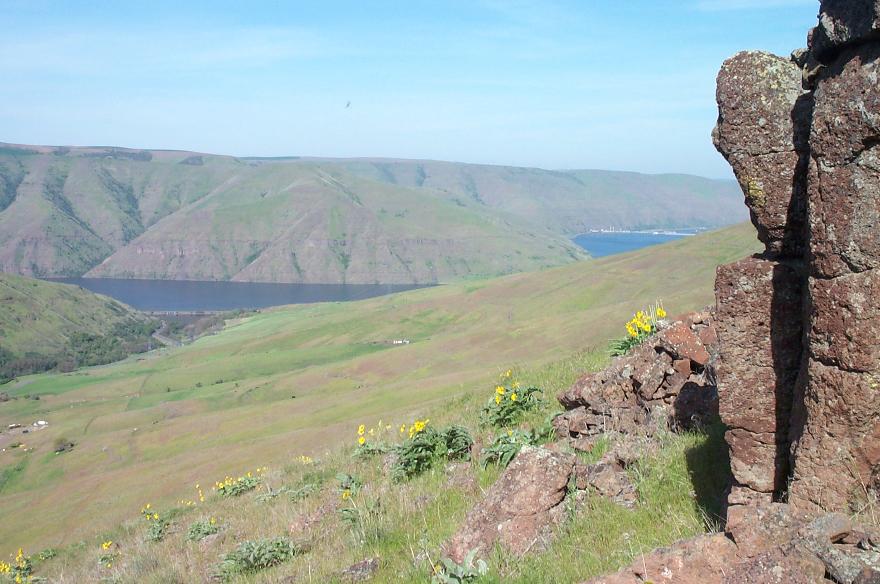
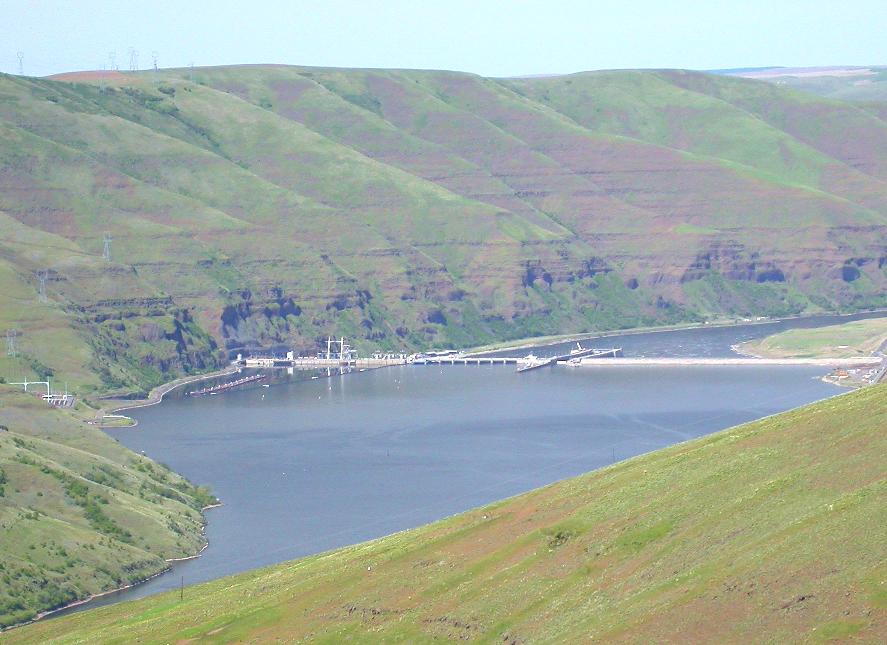
From this same vantage point, one sees the Snake River Canyon to
their right. This view looks almost due west.
One can see that the river flows toward the north and makes a ninety-degree turn to the west. Enlarged view, 84kb
|
|
Lower Granite Dam appears in the distance, a bit over four miles away. I worked there as a power plant operator from 1976 until my retirement in 1996. Each day (or night) I'd launch our boat at Wawawai Landing, just out of view to the left, and motor the four miles to the dam. I'd tie off at the navigation lock upstream guide wall and walk across to the south end where the control room is located. It sounds time-consuming, but it wasn't all that bad. My record time from inside our house to the control room was something like twenty minutes.
|
|
Even though the distance is over three miles, a 4X camera zoom brings the
dam close enough to show the general layout.
Near the left (south) end one can see the elevator "penthouse" just above a dark shadow on the face of the dam. The H-shaped structure is the 500,000 volt transmission line "takeoff tower." Enlarged view, 79kb
|
|
|
The series of dashes are the eight spillway gates. The structure pointing up-stream/down-stream is the navigation lock. Protruding into the forebay is the floating guidewall leading into the lock. Because the water is well over 100-feet deep, here, it is impractical to build a guidewall that rests on the bottom. So, this all concrete structure was designed to float. (It is hollow, like a boat.) I kept my boat tied off to the guidewall while on duty. The right hand side consists of the earth-filled portion of the dam. Lower Granite is the last of a series of eight locks and dams that permit vessels to navigate from the Pacific Ocean to the "seaport" of Lewiston, Idaho. Most of the cargo is hauled in barges of about 3,000-tons capacity. The lock will accomodate a tow of five barges and one tugboat. Mostly, the commodities consist of wheat (from as far away as North Dakota), logs, wood chips, paper products from the Potlatch mill in Lewiston, dried peas and lentils, and petroleum products.
|

|
Towboats ply the waters of the Snake River on a daily basis. Here, the
Captain Bob heads downstream with two loaded grain barges. It will pick
up more at terminals along the way; by the time it reaches the Columbia
River the tow will likely consist of four barges, each carrying
100,000 bushels, the four totaling about 12,000 tons of product. It is a marvelously
efficient way of moving commodities.
Enlarged view, 69kb
|
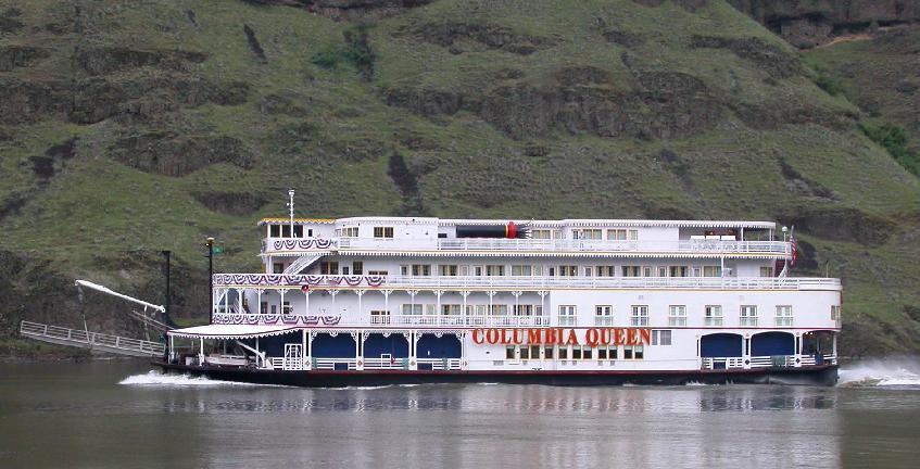
| Here, the gaily decorated cruse boat Columbia Queen heads upstream to Lewiston, Idaho, with a load of vacationers. The passengers should be out on deck because this is one of the more spectacular sections of the entire route from Portland, Oregon, to Lewiston. |
|
|
Enlarged view, 73kb
Note that the faux smokestacks have been lowered to clear bridges and navigation lock structures. The Columbia Queen is not a sternwheeler, but another cruise boat, the Queen of the West, graces these waters sporting a handsome stern wheel.
|
|
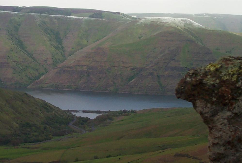
The Snake River Canyon is about 1,500-feet deep at this point. About 120-miles upstream it becomes Hells Canyon, a mile-deep slash in the earth's crust. It's the deepest gorge in North America and amongst the deepest in the world.
Enlarged view of Hells Canyon, 85kb
|

|
|
Even at a comparatively shallow 1,500-feet, our canyon enjoys its own
micro-climate, sometimes being as much as 20-degrees warmer in the
winter than the surrounding countryside. It's an added curse in the
summer months, though, typically being 5 to 7-degrees hotter. The
complete absence of humidity makes it very tolerable, however, and in
the evening the cooler air flows down from above.
An added bonus to our dry climate is the freedom from mosquitoes. We can enjoy our evenings outdoors without being eaten alive. |
|
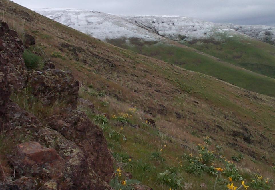
Like the brooding Hells Canyon, ours has its moods, too.
This May 7th scene would produce a flurry of poetry from the likes of Poe.
Enlarged view, 59kb.
|
|
A look to the east brought no hope for a warming ray of morning sun.
Enlarged view, 85kb
|
|
Click here to see more of the canyon
or,
Click here to return to Orrin & Cathy's opening page
Copyright © 1998-2007, Orrin B. Iseminger
Revised -- 1/18/07